
LEAD ANALYST
Utkarsh Khirodkar is a Lead Market Research Analyst at MetaStat Insight, specializing in market intelligence, technology sector assessments, and competitive strategy.

Global Geospatial Surveying and Mapping Market Size, Share, By Service Type (Land & Cadastral Surveying, Engineering & Topographic Surveying, Construction Surveying & As-Built Verification, Aerial Mapping & Photogrammetry, Hydrographic & Bathymetric Surveying, Utility & Subsurface Mapping, 3D Reality Capture & Scan-to-Model Services, GIS Mapping & Spatial Data Services, Geodetic & Control Surveying, Deformation & Monitoring Surveying), By Technology (Conventional Total Station & Leveling, GNSS/GPS & RTK Surveying, Terrestrial Laser Scanning, Mobile LiDAR & Mobile Mapping, UAV/Drone Photogrammetry & LiDAR, Manned Airborne Photogrammetry & LiDAR, Satellite Remote Sensing, Sonar & Marine Survey Systems, Ground-Penetrating Radar & Electromagnetic Locating, Others (SLAM Wearables, Robotic and Autonomous Survey Platforms)), By End-Use Industry (Transportation Infrastructure, Buildings & Real Estate, Utilities & Telecommunications, Power & Renewable Energy, Oil, Gas & Pipelines, Water & Wastewater, Government, Defense & Public Safety, Mining & Natural Resources, Marine, Ports & Coastal Infrastructure, Others (Agriculture, Forestry, Cultural Heritage)), Industry Analysis, Growth, Trends, and Forecast, 2026-2033
Report ID
MSI-5240
Published
September, 2026
Pages
257 Pages
Format
Historical
Base year
Forecast
Forecast period
Report Details
Market Valuation: Valued at $23.8 Billion in 2025, projected to reach $44.8 Billion by 2033 at a 8.2% CAGR.
Dominant Segment: The Engineering & Topographic Surveying segment leads the market, driven by rising investments in urban development and infrastructure maintenance, projected to reach USD 6.7 billion by 2033.
Geographic Lead: The North American region is anticipated to grow fastest due to significant infrastructure modernization initiatives and increased capital investments in geospatial technologies.
What's Inside: The report provides comprehensive competitive coverage, detailed analyses of market dynamics, and forecasts extending to 2033 across various segments and technologies.
Emerging Demands: Technological innovations in mobile mapping and aerial photography are driven by rapidly expanding urbanization, enhancing operational efficiency and data accuracy in geospatial services.
Choose Your License
Global Geospatial Surveying and Mapping Market
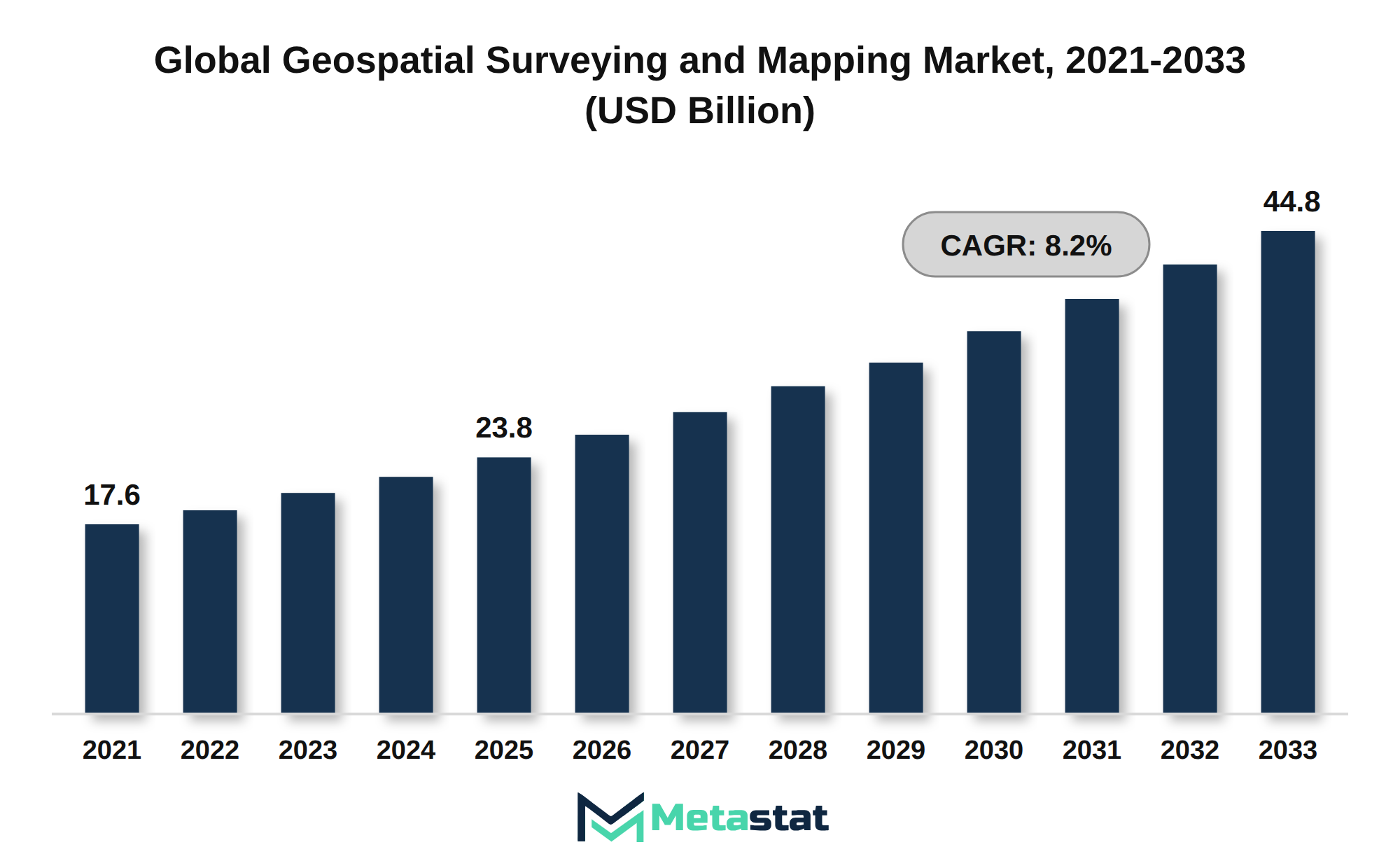
The global Geospatial Surveying and Mapping market was valued at USD 23.8 billion in 2025 and is projected to reach USD 44.8 billion by 2033, growing at a CAGR of 8.2% over the forecast period.
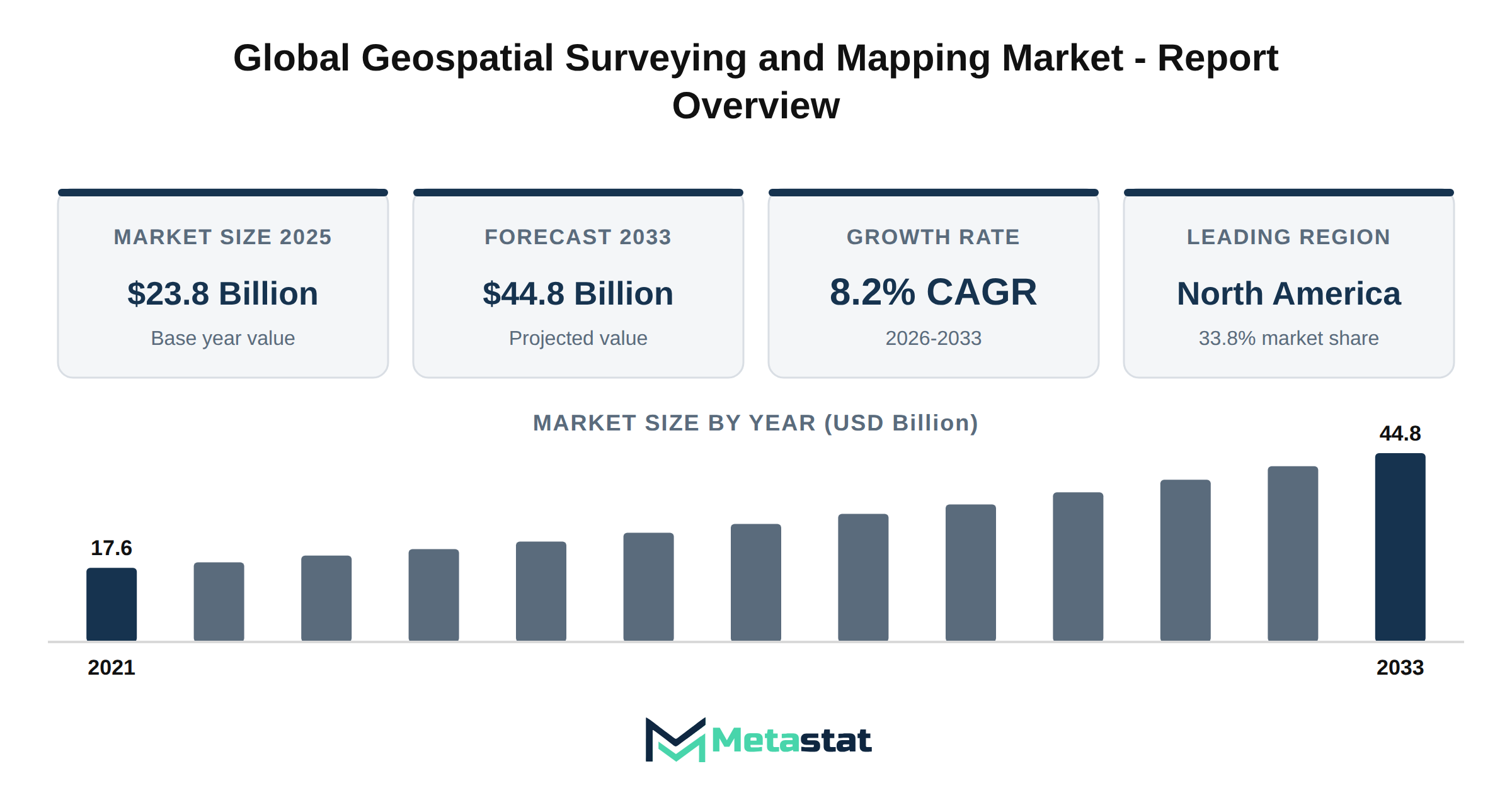
The global Geospatial Surveying and Mapping market reached a valuation of USD 23.8 billion in 2025 and is projected to expand to USD 44.8 billion by 2033, representing a compound annual growth rate (CAGR) of 8.2%. Historical data shows an increase from USD 17.6 billion in 2021 to USD 20.5 billion in 2023, illustrating steady market growth. This growth trajectory reflects rising demand for advanced surveying technologies and mapping solutions across various industries.
LiDAR adoption trends illustrate a significant shift in how geospatial data is captured and applied. The technology enables high-resolution mapping and has gained traction in sectors including transportation and utilities. Demand for UAV and drone mapping across infrastructure projects has surged due to the need for efficient site assessments and real-time data acquisition, enhancing project timelines and accuracy.
Technological advancements in GNSS and RTK surveying continue to enhance positioning accuracy, supporting applications in construction and agriculture. The integration of 3D reality capture and digital twin technology facilitates comprehensive modeling and simulation, driving efficiencies in planning and execution. Adoption of mobile mapping and Simultaneous Localization and Mapping (SLAM) technology supports dynamic data collection, particularly in urban environments where traditional surveying methods fall short.
The incorporation of AI and automation in geospatial data processing enhances data analysis capabilities, allowing for quicker insights and improved decision-making. Adoption of cloud-based GIS and mapping platforms streamlines processes, enabling remote access to essential data while improving collaboration across teams. Satellite remote sensing applications in surveying and mapping provide critical information for environmental monitoring and resource management.
Infrastructure modernization serves because a primary driver of geospatial surveying demand, with significant investments directed towards upgrading transportation systems and public utilities. Opportunities in transportation infrastructure surveying and mapping are expanding, necessitating accurate data for the planning and execution of new projects. Trends in utility and subsurface mapping reflect a growing focus on maintaining and upgrading existing infrastructure to ensure safety and efficiency.
Renewable energy expansion supports growth in geospatial surveying, with increased need for site assessments and resource mapping in wind and solar projects. The construction and real estate sectors exhibit strong demand for as-built mapping services, which provide essential documentation for project completion and compliance. Hydrographic and bathymetric surveying market opportunities are emerging, driven by the need for accurate marine data for navigation and environmental conservation.
The Geospatial Surveying and Mapping market experiences significant advancements driven by LiDAR technology. The integration of LiDAR enhances data accuracy and efficiency in capturing detailed topographic information, benefiting various sectors including construction and infrastructure development. The increasing adoption of UAV and drone mapping solutions further supports infrastructure projects, allowing for rapid data collection and analysis, resulting in cost savings and improved project timelines.
GNSS and RTK surveying technology advancements play a crucial role in improving positional accuracy. These technologies facilitate precise measurements for various applications, including construction, agriculture, and transportation. The ongoing development of 3D reality capture and digital twin integration leads to enhanced visualization and analysis capabilities, enabling better decision-making for project stakeholders.
Mobile mapping and SLAM (Simultaneous Localization and Mapping) technology adoption contribute to the efficiency of surveying processes. These innovations allow for real-time data collection in diverse environments, streamlining workflows and enhancing productivity. The rise of AI and automation in geospatial data processing optimizes data analysis, improves accuracy, and reduces the time required for project completion.
Cloud-based GIS and mapping platform adoption facilitates collaboration and data sharing among stakeholders. These platforms enable access to geospatial data, promoting innovation and enhancing project outcomes. Satellite remote sensing applications in surveying and mapping provide valuable insights into land use, environmental monitoring, and urban planning, further driving demand in the market.
Infrastructure modernization initiatives significantly impact geospatial surveying demand. Investments in transportation infrastructure create opportunities for surveying firms to provide detailed mapping and analysis services. Demand trends in utility and subsurface mapping continue to rise, driven by the need for accurate infrastructure assessments and maintenance planning.
The expansion of renewable energy projects supports growth in the market, with geospatial surveying playing a vital role in site selection, planning, and monitoring. The construction and real estate sectors exhibit increasing demand for as-built mapping services, ensuring compliance and accuracy in project delivery. Hydrographic and bathymetric surveying market opportunities arise from the need for detailed marine mapping, particularly in coastal and offshore projects.
Demand for geospatial mapping in mining and natural resources continues to grow, driven by the need for exploration, environmental assessments, and resource management. Government and defense investments in geospatial mapping technologies enhance national security and improve public safety through better planning and response strategies.
Smart city initiatives drive demand for high-precision mapping solutions. These projects require accurate data to support urban planning, transportation systems, and infrastructure management. Trends in autonomous surveying and robotic mapping technology reflect the industry's shift towards increased automation, reducing labor costs and enhancing operational efficiency.
Geospatial data accuracy and real-time mapping requirements influence surveying equipment and software innovation trends. Continuous advancements in technology lead to improved capabilities and functionality in surveying instruments. Pricing dynamics impact project costs, with competitive pressures driving the need for cost-effective solutions in the market.
Surveying workforce shortages and automation adoption present challenges and opportunities within the industry. Addressing workforce gaps through technology integration enhances operational efficiency and productivity. Geospatial data standards and regulatory developments shape the market, ensuring consistency and quality in data collection and analysis.
Public infrastructure investment significantly impacts surveying demand, with government initiatives fueling growth in the market. Mergers, acquisitions, and partnerships among geospatial service providers strengthen competitive positioning and expand service offerings. The competitive landscape of the Geospatial Surveying and Mapping market features a diverse range of players, each contributing to the industry's growth and innovation.
Growth opportunities in North America reflect strong demand for geospatial surveying services, driven by infrastructure projects and technological advancements. Europe experiences increasing demand for digital infrastructure, enhancing the market's potential. The Asia Pacific region demonstrates market expansion fueled by rapid urbanization and infrastructure development, highlighting emerging opportunities in the geospatial surveying sector.
Future trends in the Geospatial Surveying and Mapping market indicate a focus on integrating advanced technologies and expanding service offerings to meet evolving customer needs. The industry anticipates continued growth driven by demand for accurate geospatial data and innovative solutions.
Growth in the Geospatial Surveying and Mapping market stems from macro-economic factors, particularly robust capital investment environments. Increasing GDP growth and favorable interest rates enhance public and private spending capabilities, facilitating investments in geospatial technologies. This trend boosts demand across various sectors, including transportation infrastructure, utilities, and urban development.
Digital transformation significantly influences the market, with organizations pursuing technological integration to optimize operational efficiency. Automation, artificial intelligence, and the digitization of legacy processes enhance data collection and analysis, driving the adoption of advanced surveying techniques. This technological shift improves data accuracy and reduces project timelines, attracting more stakeholders to the market.
Shifting demographic patterns, including urbanization and changing consumer behaviors, further fuel market growth. An increasing urban population drives the need for efficient land use and infrastructure development, necessitating precise geospatial data. The focus on sustainability and resource stewardship among consumers compels companies to adopt environmentally friendly practices, integrating geospatial solutions into their operational strategies.
Overall, these macro-economic factors contribute to the projected growth of the Geospatial Surveying and Mapping market, with a compound annual growth rate (CAGR) of 8.2% from 2026 to 2033. Investment in infrastructure and technological advancements continues to position the market for significant expansion.
Investment in infrastructure development significantly influences the growth of the Geospatial Surveying and Mapping market. Governments and private sectors prioritize upgrading physical and digital capacities, enhancing facilities and network capabilities to meet increasing demands for accurate data and efficient processes. This trend results from rising urbanization, aging assets, and the need for sustainable practices in construction and resource management.
Infrastructure projects, including transportation networks, utilities, and renewable energy initiatives, create substantial opportunities for geospatial surveying and mapping services. Enhanced government and public-private spending power leads to increased capital investments, benefiting industries including transportation, energy, and telecommunications. The market experiences growth driven by the need for precise surveying and mapping solutions that support these modernization efforts.
Technological integration within the infrastructure sector significantly influences market advancement. Automation, artificial intelligence, and software adoption streamline processes, reduce costs, and improve decision-making. The demand for innovative surveying techniques, including mobile mapping and aerial photogrammetry, continues to rise, reflecting the industry's shift toward more efficient methodologies. The Geospatial Surveying and Mapping market benefits from these modernization initiatives, creating a robust economic environment for growth.
The Geospatial Surveying and Mapping market faces challenges from regulatory and compliance hurdles that inhibit market entry and expansion. Stringent regulations surrounding data accuracy, privacy, and environmental impact affect the operational capabilities of service providers. These requirements necessitate considerable investment in compliance processes and technology, which impacts overall profitability.
Legal mandates related to data security and ownership create complexities in project execution. Companies navigate these complexities while ensuring adherence to local and international standards, resulting in project delays and increased costs. Macroeconomic factors, including inflationary pressures and rising operational costs, exacerbate these issues by straining budgets and limiting available resources for compliance-related investments.
The fragmented nature of the market complicates compliance efforts. Smaller firms often lack the financial and technical resources to meet rigorous standards, which reduces their competitiveness. Larger players in the Geospatial Surveying and Mapping market focus on securing high-value contracts, which leaves lower-tier companies marginalized and unable to participate effectively.
This environment creates significant barriers to entry for new entrants and restricts innovation within the industry. Consequently, the combination of stringent regulatory requirements, increased operational costs, and market fragmentation hampers growth opportunities and overall demand within the market.
The Geospatial Surveying and Mapping market encounters significant challenges stemming from geopolitical fragmentation and trade barriers. Tensions between nations lead to trade deficits and tariff friction, complicating international supply chains. These conditions affect the availability of essential components and feedstock, resulting in increased costs and delays in project execution. Companies in the market experience pressures on pricing and margins, driven by the adapt to fluctuating tariffs and supply volatility.
Technological disruptions further complicate operations within the market. Rapid advancements in surveying technologies necessitate continuous research and development investments. The integration of new technologies poses interoperability challenges, particularly when aligning with existing systems and protocols. Firms face pressure to maintain compliance with tightening global regulatory standards, which increases compliance overhead and legal liabilities. The evolving environment of cybersecurity risks and data vulnerabilities requires heightened vigilance, demanding additional resources and expertise.
Workforce skill gaps present another barrier. The market requires specialized skills to implement advanced surveying technologies effectively. Competition for skilled talent intensifies, leading to talent retention pressures in an evolving labor market. This situation exacerbates the challenges associated with automation displacements, where traditional roles change owing to companies adopting innovative technologies.
Infrastructure gaps contribute to the complexities faced by the market, with retrofitting barriers hindering the adoption of modern surveying practices. Implementation bottlenecks arise from insufficient infrastructure readiness, particularly in developing regions. These factors collectively limit the market's growth potential and necessitate strategic adaptations by companies striving to maintain competitive advantages in a rapidly changing environment.
Rapidly expanding urbanization and industrialization across various regions fuel the Geospatial Surveying and Mapping market. Growing demands for accurate data and efficient land use planning necessitate technological innovations, particularly in mobile mapping and aerial photography. Consequently, companies adopting these advanced surveying techniques enhance their competitive edge through improved operational efficiency and data accuracy.
Infrastructure modernization projects contribute significantly to market growth. Nations prioritize upgrading transportation networks, utilities, and telecommunications systems, generating substantial demand for geospatial services. Investments in smart city initiatives and sustainable urban development create further opportunities for service providers, enabling alignment with environmental goals and achieving better project outcomes.
Geographical expansion of services opens new market dynamics, particularly in developing economies. Organizations targeting regions with emerging economies position themselves strategically to leverage local infrastructure projects. This expansion allows suppliers to tap into previously underserved markets, driving revenue growth and market penetration.
Technological disruptions, including the integration of artificial intelligence and machine learning in mapping processes, enhance data analysis capabilities. These innovations support faster decision-making and improve accuracy in surveying. Consequently, businesses adopting these technologies experience increased operational yield and reduced costs, positioning themselves favorably in a competitive environment.
The shift towards digital transformation reshapes purchasing behaviors within the Geospatial Surveying and Mapping market. Companies increasingly favor digital procurement solutions and online platforms for sourcing geospatial services. This trend drives service providers to optimize their offerings through enhanced customer engagement and tailored solutions, promoting sustained growth.
Sustainability imperatives significantly influence market dynamics. Organizations increasingly align operations with environmental, social, and governance (ESG) criteria, creating demand for eco-friendly surveying practices. The focus on green transformations drives service providers to innovate and integrate sustainable practices into their operations, supporting market growth.
Strategic consolidation among players enhances competitive positioning within the market. Mergers and acquisitions enable companies to diversify service portfolios, expand geographic footprints, and leverage complementary technologies. These strategic moves create robust players that capture larger market shares and respond effectively to evolving customer demands.
The growing emphasis on value-chain optimization leads to process automation, enhancing operational efficiency. Businesses that streamline workflows and integrate advanced technologies achieve significant productivity gains and cost reductions. This operational yield maximization positions them advantageously within the competitive landscape of the Geospatial Surveying and Mapping market.
The Global Geospatial Surveying and Mapping market is segmented based on Service Type, Technology, and End-Use Industry.
Valued at USD 3.6 billion in 2026, the Land & Cadastral Surveying segment in the Geospatial Surveying and Mapping market is projected to reach USD 5.6 billion by 2033, with a compound annual growth rate (CAGR) of 6.7% during the forecast period. Primary demand drivers for this segment include the increasing need for accurate land records, urban planning, and property management. This segment benefits from technological advancements that enable more efficient surveying methods and improve data accuracy.
Adoption of advanced technologies, including GIS and satellite imaging, enhances the effectiveness of land surveying, leading to expanded applications across various sectors. The growth of the construction industry, coupled with regulatory compliance for land management and urban development, fuels segment expansion. Rising investments in infrastructure projects stimulate demand for comprehensive land and cadastral surveying services, supporting the segment's trajectory.
End-use dynamics highlight the significance of precise land data in sectors including real estate, government, and environmental management. Consumption shifts toward digital solutions and automated surveying techniques drive the evolution of products and services within this segment. The ongoing focus on regulatory compliance and certification standards further emphasizes the importance of accurate land surveying in maintaining land integrity and ownership records.
Overall, the Land & Cadastral Surveying segment plays a critical role in the broader Geospatial Surveying and Mapping market, supported by strategic opportunity windows and capital investment outlooks that promise continued growth and innovation.
Growing demand for precision in construction and infrastructure projects drives the expansion of the Engineering & Topographic Surveying segment within the Geospatial Surveying and Mapping market. This segment benefits from increasing investments in urban development and infrastructure maintenance, leading to enhanced measurement accuracy and improved project timelines. The shift towards next-generation technologies including GNSS/GPS and terrestrial laser scanning supports operational efficiencies, enabling companies to deliver services that meet evolving project requirements.
The Engineering & Topographic Surveying segment is projected to reach USD 6.7 billion by 2033, at a CAGR of 7.4% during the forecast period. The rising complexity of infrastructure demands sophisticated surveying techniques, allowing firms to enhance their service offerings. Regulatory compliance standards related to safety and environmental impact necessitate detailed and accurate surveying data. This segment's growth reflects the market's response to increased demand for detailed geospatial data across various industries, including transportation, utilities, and real estate.
Technological maturation continues to benefit the segment through improved tools and methodologies that enhance data accuracy and efficiency. Companies investing in the latest technologies, including drone-based surveying and advanced mapping software, position themselves favorably in the competitive landscape. The ongoing evolution of product offerings and services in the Engineering & Topographic Surveying segment strengthens its role in the Geospatial Surveying and Mapping market, contributing to an optimistic outlook for growth and innovation.
Construction Surveying & As-Built Verification represents a critical segment within the Geospatial Surveying and Mapping market, emphasizing the need for precise measurements and validations throughout the construction process. The anticipated growth in this segment is driven by increasing investments in infrastructure and real estate development, compelling stakeholders to adopt advanced surveying techniques to ensure compliance and accuracy. Technological advancements, particularly in mobile mapping and drone-based surveying, enhance operational efficiency and data accuracy, further propelling market expansion.
In the context of regulatory compliance standards, heightened scrutiny surrounding construction quality and safety protocols necessitates robust surveying practices. This demand for precision influences the decision-making processes of construction firms and contractors, resulting in a significant increase in the adoption of Construction Surveying & As-Built Verification services. The segment is expected to reach USD 5.3 billion by 2033, reflecting a growing recognition of the importance of geospatial technologies in optimizing project outcomes.
End-use industries, including transportation infrastructure and utilities, contribute substantially to the market dynamics, driven by these sectors increasingly relying on accurate surveying for project planning and execution. The integration of next-generation surveying technologies facilitates improved data collection methods, allowing for real-time analytics and enhanced project management capabilities. Overall, the Construction Surveying & As-Built Verification segment drives growth through technological innovation and an unwavering focus on precision.
Growth in the Aerial Mapping & Photogrammetry segment aligns with technological advancements in drone capabilities and imaging technologies. These advancements drive demand across industries including construction, agriculture, and environmental monitoring, where detailed landscape analysis and data accuracy are critical. The segment is projected to grow at a CAGR of 8.9% during the forecast period.
Increasing adoption of geospatial data analytics among end-users contributes significantly to segment expansion. Companies leveraging aerial mapping enhance operational efficiency and decision-making processes, leading to stronger competitive positioning. The integration of cloud-based platforms facilitates effective data sharing and analysis, further supporting industry growth.
Regulatory compliance standards regarding environmental assessments and land use planning create additional demand for aerial mapping services. These standards require precise and updated geographical data, prompting stakeholders to invest in advanced aerial mapping solutions. Consequently, companies in the Geospatial Surveying and Mapping market adapt to meet these regulatory requirements, positioning themselves favorably for future growth.
Clients prioritize cost-effective solutions while seeking high-quality results, leading to innovations in pricing structures and service delivery models. Companies focusing on technological enhancements, including the use of artificial intelligence in data processing, improve productivity and reduce operational costs. This trend creates a competitive environment where firms strive to deliver superior outcomes at attractive price points, subsequently boosting market penetration.
While the demand for comprehensive mapping solutions rises, investments in next-generation aerial mapping technologies become essential. Strategic opportunities arise for firms willing to explore innovative approaches and capitalize on emerging trends within the Geospatial Surveying and Mapping market. Continuous product evolution enhances service offerings and addresses changing customer needs, thereby reinforcing the segment's growth trajectory.
Hydrographic and bathymetric surveying is essential in various applications, including marine navigation, coastal engineering, and environmental monitoring. Increasing investment in marine infrastructure and heightened awareness of sustainable practices drive demand for accurate underwater mapping. Enhanced data collection techniques and advances in sonar technology facilitate the production of high-resolution maps, enabling industries to optimize operations and improve safety measures. The rising need for environmental assessments pushes the adoption of these surveying techniques, particularly in regions with significant maritime activities.
Integration of next-generation technologies, including unmanned aerial vehicles (UAVs) and autonomous underwater vehicles (AUVs), transforms traditional methods of hydrographic surveying, leading to increased efficiency and reduced operational costs. This trend aligns with broader shifts within the Geospatial Surveying and Mapping market, where technological maturation drives innovation and attracts investments from various sectors. Regulatory standards regarding maritime safety and environmental protection further contribute to the growth of hydrographic and bathymetric surveying, necessitating adherence to stringent compliance measures within the industry.
While industries shift towards more data-driven strategies, the demand for reliable underwater mapping solutions continues to increase. Shifting consumption patterns toward environmentally friendly practices and sustainable resource management reinforce the importance of hydrographic surveying in supporting strategic decision-making. This segment's development opens strategic opportunity windows for stakeholders to innovate and meet the evolving needs of end-users across diverse maritime industries.
Demand for Utility & Subsurface Mapping services continues to strengthen due to the growing need for accurate underground infrastructure data. This segment serves industries including construction, utilities, and telecommunications, which rely on precise subsurface information to avoid costly errors and enhance project efficiency. The rise in infrastructure projects and urban development emphasizes the need for effective mapping solutions, ensuring that utilities are accurately located and mapped.
Adoption of advanced technologies, including ground-penetrating radar and electromagnetic locating systems, contributes to the segment's expansion. These technologies enhance the ability to detect underground structures and utilities, which is crucial for safe excavation and construction. Continuous technological maturation encourages the integration of next-generation upgrades in equipment, improving the accuracy and efficiency of mapping processes.
End-use dynamics reflect a shift towards more sophisticated mapping solutions, driven by regulatory compliance standards and safety requirements. Companies increasingly prioritize certifications that validate the accuracy of their mapping services, reinforcing trust among clients in sectors like construction and utilities. Heightened demand for reliable data and compliance with industry regulations drives growth in the geospatial surveying and mapping market.
Pricing volatility in raw material sourcing impacts cost structures across the segment. Fluctuations in prices for essential materials and technologies influence overall project budgets, prompting firms to seek cost-effective solutions without compromising quality. Supply chain resilience ensures that companies maintain a steady flow of materials and technologies crucial for effective utility and subsurface mapping.
Strategic opportunity windows arise from increasing government investments in infrastructure and urban planning. These investments create a conducive environment for utility and subsurface mapping, highlighting the significance of accurate data in the planning and execution of projects. Companies positioned to leverage these opportunities enhance their competitive edge within the market, ensuring sustained growth and innovation.
Growing interest in 3D Reality Capture & Scan-to-Model Services emerges from the increasing need for accurate and efficient data collection across various industries. The capabilities of these services address the demand for detailed spatial data that supports complex modeling and visualization processes. Advances in technology, including the integration of high-resolution imaging and scanning technologies, enhance the quality and speed of data collection, thereby facilitating wider adoption within the market.
Industries including construction, urban planning, and manufacturing leverage 3D Reality Capture to improve project outcomes and reduce delays. The ability to create detailed three-dimensional models from real-world data allows for better planning, monitoring, and management of assets throughout their lifecycle. These capabilities align with the overall trends in the Geospatial Surveying and Mapping market, where precision and efficiency are essential.
The trend toward digital transformation in various sectors drives demand for innovative solutions, positioning 3D Reality Capture because a critical component in modern surveying practices. The emphasis on improved accuracy and reduced costs in project delivery further drives growth. Strategic investments in technology and training will enhance the operational capabilities of industry players, ultimately contributing to the ongoing evolution within the market.
Increasing reliance on geographic information systems (GIS) for decision-making drives advancements in GIS Mapping & Spatial Data Services within the Geospatial Surveying and Mapping market. Key developments in data analytics, software tools, and cloud-based solutions improve functionality and accessibility of these services, enabling businesses to leverage spatial data for various applications. Growing urbanization and infrastructure planning increase demand for accurate mapping solutions that enhance project delivery and efficiency.
Technological maturation acts because a catalyst for segment expansion. Enhanced capabilities in data collection, processing, and visualization encourage adoption across industries, particularly within transportation, utilities, and urban planning. Adoption of next-generation upgrades, including real-time data integration and enhanced mobile access, enhances user engagement and improves operational efficiencies.
End-use dynamics reflect a shift toward data-driven decision-making in sectors including construction, where precise mapping supports project accuracy and reduces risks. Regulatory compliance standards increasingly emphasize the importance of accurate spatial data, driving investment in GIS Mapping & Spatial Data Services. This trend positions the segment because a strategic opportunity for companies aiming to capture market share and meet evolving client demands.
Cost structures exhibit variability influenced by technological investments and personnel training. Pricing volatility arises due to competition among service providers and advancements in technology that alter service delivery models. Organizations focusing on GIS Mapping & Spatial Data Services benefit from supply chain resilience, leveraging strategic partnerships to enhance data quality and accessibility. Overall, capital investment outlook in the segment remains positive, reflecting growing recognition of the value of spatial data across diverse applications.
Growth in Geodetic & Control Surveying aligns with the increasing need for accurate spatial data across various industries. Demand for precise measurements and control points in large-scale projects drives adoption among construction, engineering, and urban planning sectors. Infrastructure development and land management activities significantly influence the requirement for these services, because accurate geospatial information becomes essential for effective project management.
Technological advancements enhance the capabilities of Geodetic & Control Surveying. Innovations in GNSS technology and terrestrial laser scanning provide improved accuracy and efficiency, supporting the evolution of surveying practices. Enhanced data collection methods facilitate integration with Geographic Information Systems (GIS), enabling more sophisticated data analysis and visualization, ultimately benefiting end users across different sectors.
Regulatory compliance standards influence the market, because adherence to strict guidelines ensures the reliability and validity of survey data. Various certifications and industry best practices contribute to establishing trust and credibility in the Geospatial Surveying and Mapping market. Companies that align their offerings with these standards position themselves favorably, attracting clients who prioritize accuracy and compliance.
Strategic opportunity windows arise from increasing investments in smart cities and infrastructure modernization. The push for sustainable development encourages the adoption of geospatial technologies to support environmental monitoring and resource management. Market players focusing on these trends enhance their competitive edge and capitalize on growth prospects within the Geospatial Surveying and Mapping market.
Demand for Deformation & Monitoring Surveying services arises from the necessity for accurate measurements and assessments in infrastructure and construction projects. This segment finds application in monitoring structural integrity, assessing subsidence, and ensuring compliance with regulatory standards. The growing emphasis on safety in construction practices drives adoption among engineering firms and governmental organizations.
Technological advancements play a significant role in evolving this segment, with the introduction of high-precision instruments and software enabling real-time data collection and analysis. These innovations enhance the ability of professionals to conduct thorough assessments, thereby increasing demand among end-users including civil engineering and environmental monitoring sectors.
Regulatory compliance standards increasingly shape the landscape for Deformation & Monitoring Surveying, necessitating adherence to strict guidelines in construction and infrastructure development. This regulatory environment influences service providers to invest in advanced technologies and methodologies to ensure compliance. Consequently, these dynamics contribute to the overall growth of the Geospatial Surveying and Mapping market.
Strategic opportunity windows arise from the market experiencing a shift toward integrated solutions that encompass a combination of surveying techniques and technologies. This integration allows service providers to offer comprehensive packages, effectively meeting diverse client needs and enhancing value proposition. The potential for collaboration between companies in the Geospatial Surveying and Mapping market increases opportunities for innovation and service evolution.
Strong demand for precision in surveying applications drives growth in the Conventional Total Station & Leveling segment, valued at USD 3.2 billion in 2026 and projected to reach USD 4.1 billion by 2033, reflecting a CAGR of 3.7% during the forecast period. Increasing adoption of these technologies across various sectors, including construction and civil engineering, influences demand for accurate measurements and data collection. The market benefits from technological advancements, including enhanced measurement accuracy and efficiency, which improve operational outcomes for end-users.
Key factors, including the need for regulatory compliance in construction and infrastructure projects, support the segment's growth. Organizations strive to meet stringent standards, necessitating the use of reliable surveying equipment. Consequently, investment in Conventional Total Station & Leveling technologies becomes critical for firms aiming to remain competitive within the Geospatial Surveying and Mapping market. The segment experiences expansion due to evolving consumer preferences for more efficient and precise surveying solutions.
Next-generation upgrades, including integration with software systems and data analytics, enhance the functionality of Conventional Total Station & Leveling tools. These innovations provide users with comprehensive insights and improved project management capabilities. While the sector evolves, the requirement for skilled operators proficient in new technologies grows, ensuring that workforce training remains a priority. This continuous evolution contributes positively to the segment's performance and long-term viability within the market.
Demand for GNSS/GPS & RTK Surveying services aligns with the growing need for accuracy in surveying and mapping applications. This segment is driven by advancements in satellite technology and increasing integration of GNSS systems in various industries, including construction, transportation, and agriculture. The ongoing shift towards automation and precision in construction projects contributes to this growth, making GNSS/GPS & RTK Surveying essential for effective project management and execution.
Technological advancements in GNSS systems enhance their capabilities, enabling real-time data processing and high-precision measurements. The increasing adoption of these technologies across various end-use industries drives demand for efficient surveying solutions. The market's evolving landscape highlights the importance of continuous innovation in GNSS technology, including the introduction of next-generation RTK systems that provide improved accuracy and reliability.
GNSS/GPS & RTK Surveying segment is estimated to reach USD 6.7 billion by 2033, at a CAGR of 7.4% during the forecast period. This growth reflects the segment's vital role in supporting infrastructure projects and urban planning initiatives. With regulatory standards emphasizing the need for precise mapping and surveying, investments in GNSS technology are expected to increase, driving market expansion.
End-use dynamics show strong demand from transportation infrastructure projects, where GNSS/GPS & RTK Surveying plays a critical role in ensuring safe and efficient operations. The integration of these surveying solutions into smart city initiatives further enhances their relevance, because municipalities seek to leverage technology for better urban planning and resource management. The market's trajectory indicates a robust future, driven by technological maturation and strategic investments in GNSS solutions.
Advancements in surveying technology significantly enhance the capabilities of professionals across various sectors. Terrestrial Laser Scanning, a sophisticated method for capturing high-resolution 3D images, increases the accuracy and efficiency of data collection. Rising demand for precise measurements in fields including construction, architecture, and heritage conservation drives anticipated growth in this segment.
Valued at USD 5.4 billion by 2033, Terrestrial Laser Scanning benefits from the ongoing evolution of scanning technologies, which improve data capture and processing speeds. These advancements facilitate the integration of laser scanning with other geospatial data collection methods, expanding its application in urban planning and environmental monitoring. The ongoing shift toward digitalization in various industries fuels adoption of Terrestrial Laser Scanning, making it a vital component in the overall Geospatial Surveying and Mapping market.
Investments in research and development within this segment promote innovations that address evolving market needs. Growing emphasis on sustainability and regulatory compliance in construction and infrastructure projects enhances demand for this technology. This trend highlights the strategic importance of Terrestrial Laser Scanning in achieving project accuracy while minimizing environmental impact.
Rapid advancements in mobile mapping technologies drive significant growth in the Mobile LiDAR & Mobile Mapping segment. Increased demand for high-resolution 3D data and efficient mapping solutions contributes to this development. Industries including transportation and urban planning rely heavily on precise mapping services for infrastructure development and maintenance. The segment is projected to grow at a CAGR of 10.6% during the forecast period. Innovations in mobile mapping equipment enhance operational capabilities, enabling data collection quickly and accurately in diverse environments.
Cost efficiencies associated with mobile mapping technologies attract investment from various sectors. The ability to integrate data with existing geographic information systems (GIS) encourages widespread adoption across multiple applications. Demand for these technologies extends beyond traditional surveying, influencing sectors including construction, utilities, and environmental monitoring. The growing emphasis on real-time data analysis further drives the Mobile LiDAR & Mobile Mapping segment within the broader Geospatial Surveying and Mapping market.
The integration of next-generation upgrades, including artificial intelligence and machine learning, enhances the functionality of mobile mapping solutions. Regulatory compliance standards related to surveying practices encourage investment in state-of-the-art technologies, ensuring accuracy and reliability. While the market evolves, strategic opportunities arise for providers to develop innovative solutions that address emerging needs in various industries.
Technological advancements in UAV/Drone Photogrammetry & LiDAR significantly influence the Geospatial Surveying and Mapping market. Increased adoption of drones for mapping applications stems from their ability to capture high-resolution images and data efficiently. This segment benefits from enhanced imaging quality, enabling detailed topographical analysis and spatial data collection, which are crucial for various industries.
Demand for UAV/Drone Photogrammetry & LiDAR aligns with the growing emphasis on precision in sectors including construction, agriculture, and environmental monitoring. The shift towards more accurate and reliable mapping solutions drives investments in this technology. Enhanced capabilities drive interest in applications spanning urban planning and disaster management, highlighting the segment's versatility in catering to diverse end-use requirements.
Regulatory compliance influences the segment's landscape. Evolving standards for aerial mapping and imaging necessitate adherence to safety and operational guidelines, ensuring responsible use of drone technology. This regulatory framework supports market growth by establishing trust and reliability among stakeholders.
Strategic opportunities emerge through ongoing investments in next-gen upgrades and product evolution within UAV/Drone Photogrammetry & LiDAR. Continuous improvements in drone technology and data processing capabilities present a pathway for companies to differentiate their offerings. This innovation cycle strengthens competitive positioning within the broader Geospatial Surveying and Mapping market.
End-use dynamics highlight the importance of UAV/Drone Photogrammetry & LiDAR in various applications, including land surveying, infrastructure development, and resource management. The increasing need for efficient data collection methods drives a shift in consumption patterns, boosting demand for advanced mapping solutions that deliver timely and accurate insights. This evolution emphasizes the segment's critical role in meeting the requirements of modern surveying practices.
Technological advancements drive the growth of Manned Airborne Photogrammetry & LiDAR in the Geospatial Surveying and Mapping market. Enhanced imaging capabilities and data accuracy support adoption across various sectors, including infrastructure development and environmental monitoring. Key demand drivers include the need for detailed aerial imagery and superior topographical data, essential for effective project planning and execution.
Industry players utilize advancements to offer more precise and efficient solutions. The integration of next-generation technologies supports segment expansion, allowing for improved data collection and processing. This segment benefits from evolving product offerings that cater to increasingly complex surveying requirements, enhancing operational efficiencies and reducing turnaround times.
End-use dynamics reflect heightened demand in sectors including transportation, utilities, and urban planning, where detailed geographical data is crucial for project success. Regulatory compliance standards, including environmental impact assessments, necessitate accurate mapping and monitoring, further driving growth. These factors contribute to a resilient supply chain, increasing confidence in the technology's future.
Investment in Manned Airborne Photogrammetry & LiDAR remains strong, with companies recognizing the potential for enhanced service offerings. Strategic opportunity windows arise from the growing need for accurate geospatial data, presenting avenues for innovation and market penetration. While technological obsolescence poses challenges, ongoing research and development efforts ensure the segment remains a leader in advancements, reinforcing its position within the broader Geospatial Surveying and Mapping market.
Continuous advancements in satellite remote sensing technology significantly impact various applications within the Geospatial Surveying and Mapping market. The ability to capture high-resolution images and data from space enhances monitoring capabilities across multiple sectors, particularly in environmental studies, agriculture, and urban planning. Increasing governmental and private sector investments in satellite technology stimulate demand for accurate, real-time data, essential for informed decision-making and strategic planning.
Growing awareness of climate change and the necessity for sustainable practices drive the adoption of satellite remote sensing in monitoring environmental changes and managing natural resources. Organizations apply satellite imagery to assess land use, track deforestation, and monitor water resources, aligning with global sustainability goals. Enhanced data accuracy and accessibility promote the integration of satellite remote sensing into various workflows, influencing industry standards and operational efficiencies.
Technological maturation of satellite systems creates a competitive landscape, prompting numerous players to develop innovative solutions that address specific market needs. Investments in next-generation upgrades, including advanced sensors and improved data processing capabilities, enhance the overall effectiveness of satellite remote sensing. These developments enable organizations to gather critical insights into geographic and environmental changes.
Increased collaboration between private companies and governmental agencies strengthens the supply chain resilience of satellite remote sensing services. Shared resources and expertise facilitate advancements in data collection and analysis, granting stakeholders access to comprehensive geographical information. The evolving dynamics of end-use industries further emphasize the role of satellite remote sensing in supporting various applications, from disaster management to infrastructure development.
Regulatory compliance standards and certifications related to environmental monitoring and data security reinforce the significance of satellite remote sensing in the market. Companies adhering to these frameworks experience enhanced credibility and customer trust, promoting long-term relationships with clients. The competitive landscape benefits from strategic opportunities arising from a diverse range of applications, highlighting the versatility and relevance of satellite remote sensing across industries.
Interest in Sonar & Marine Survey Systems reflects an increasing focus on underwater exploration and mapping, driven by the demand for accurate marine spatial data. This segment supports sectors including maritime navigation, environmental monitoring, and underwater construction, enhancing operational efficiency and informed decision-making.
Technological advancements significantly influence the capabilities of sonar systems, enhancing data collection and processing capabilities. The integration of sophisticated sensors and real-time data analytics improves accuracy and efficiency in marine surveys. These innovations position the segment for strategic opportunity windows, enabling firms to address the evolving needs of end-users across various industries.
Adoption trends indicate a shift toward advanced marine surveying techniques, driven by regulatory compliance standards and environmental factors. Organizations increasingly seek to align with sustainability goals, impacting the demand dynamics within the Geospatial Surveying and Mapping market. This shift highlights the necessity for continuous innovation in product evolution to meet regulatory requirements and client expectations.
Market players face challenges related to cost structures and pricing volatility, which impact profitability. However, the focus on strategic investments and supply chain resilience strengthens the capacity to mitigate risks associated with raw material sourcing and logistics vulnerabilities. These factors contribute to maintaining competitive advantage and sustaining growth within the segment.
Downstream applications of sonar technologies extend beyond traditional marine surveying, encompassing diverse fields including oil and gas exploration, renewable energy projects, and coastal infrastructure development. This broad applicability enhances the segment's relevance in the Geospatial Surveying and Mapping market, emphasizing the importance of continuous investment in next-gen upgrades and technological maturation.
Increased applications of Ground-Penetrating Radar & Electromagnetic Locating technology significantly impact various sectors, facilitating improved subsurface exploration. This technology addresses the growing demand for accurate subsurface data, particularly in construction, utilities, and environmental studies. Enhanced accuracy and efficiency in data collection encourage wider adoption among professionals tasked with mapping underground structures. Innovations in sensor technology and data processing capabilities contribute to continuous improvements in detection and imaging quality.
End-use industries including utilities and telecommunications benefit from the precise mapping of existing infrastructure, enabling better planning and management of resources. Regulatory compliance further drives the adoption of Ground-Penetrating Radar & Electromagnetic Locating, because standards require thorough assessments of subsurface conditions prior to construction. Investment in training and certification programs supports technological familiarity, enhancing operational capabilities across industries.
While the Geospatial Surveying and Mapping market evolves, strategic partnerships among technology providers and end-users facilitate the integration of advanced solutions. This collaboration promotes innovation, reducing technological obsolescence risks while optimizing the supply chain. Enhanced capital investment outlook in this segment signals a commitment to furthering research and development efforts, ensuring sustained growth and competitiveness in the market.
Integration of SLAM (Simultaneous Localization and Mapping) wearables, alongside robotic and autonomous survey platforms, indicates a significant shift in the geospatial surveying landscape. Demand for these technologies stems from their ability to enhance data collection efficiency, particularly in areas that are challenging for traditional surveying methods. Increasing applications in urban planning, construction, and environmental monitoring fuel this demand owing to stakeholders seeking precise and real-time data for informed decision-making.
Adoption of SLAM technologies has accelerated due to advancements in sensor technology and artificial intelligence, enabling more sophisticated data processing and analysis. Enterprises across various sectors, including transportation infrastructure and utilities, recognize the potential of these solutions to improve operational efficiencies and reduce project timelines. This trend reflects a broader movement towards automation and digitalization within the geospatial surveying and mapping market.
Technological maturation supports the expansion of this sub-segment. Continuous improvements in robotic capabilities and autonomous navigation systems enhance the reliability and accuracy of surveys. This evolution appeals to end-users seeking innovative solutions that reduce reliance on manual labor and streamline workflows, driving greater competitiveness within the market.
Increased focus on regulatory compliance and environmental sustainability further influences the demand for SLAM wearables and autonomous platforms. Organizations strive to meet stringent standards while reducing their environmental footprint, motivating investment in technologies that facilitate compliance and enhance data integrity. These pressures intensify, prompting companies within the market to innovate and adapt their offerings, ensuring they remain aligned with evolving industry requirements.
Strategic opportunity windows exist for players looking to invest in the development of next-generation SLAM solutions. Capital investment in research and development will likely lead to breakthroughs that enhance performance, expand application areas, and improve cost-effectiveness. This innovation trajectory is critical for maintaining relevance and capturing market share in the evolving geospatial surveying and mapping market.
Valued at USD 4.7 billion in 2026, the Transportation Infrastructure segment is projected to reach USD 8.2 billion by 2033, at a CAGR of 8.4% during the forecast period. This growth aligns with increasing governmental investments in transportation projects aimed at enhancing connectivity and improving public safety. Significant advancements in surveying technology play a crucial role in ensuring accurate planning and execution of infrastructure projects, leading to increased demand for services in this segment. The drive for sustainable and efficient transportation solutions fuels the adoption of innovative methodologies, including Aerial Mapping and Photogrammetry, which enhance the accuracy of survey data. Regulatory compliance and certification requirements in infrastructure development necessitate high-quality geospatial data, further driving demand in the Geospatial Surveying and Mapping market. The ongoing transition to smart infrastructure and intelligent transportation systems necessitates advanced survey techniques, creating opportunities for market participants. Enhanced precision in surveying activities supports operational efficiency and cost-effectiveness, making it an essential consideration for stakeholders in the transportation sector.
Growing investments in real estate development significantly drive the demand for geospatial surveying and mapping services within the Buildings & Real Estate segment. Developers and architects increasingly rely on accurate mapping and surveying data to optimize site selection, design, and construction processes. The segment is projected to reach USD 7.1 billion by 2033, reflecting a CAGR of 7.3% during the forecast period. Technological maturation, particularly in 3D modeling and laser scanning, enhances the precision and efficiency of surveying activities, attracting more stakeholders to adopt these advanced solutions.
Regulatory compliance standards around land use and zoning further stimulate demand for geospatial services. The integration of geographic information systems (GIS) allows stakeholders to analyze spatial data effectively, improving decision-making in project planning and execution. Rising urbanization and the need for infrastructure development lead to an increase in construction projects, creating a favorable environment for growth in the market.
The emergence of next-generation surveying technologies supports the expansion of this segment. Innovations including mobile mapping and drone-based photogrammetry deliver rapid data collection and real-time analysis capabilities, streamlining workflows for architects and construction firms. These advancements create a competitive environment, encouraging market participants to invest in research and development to enhance their offerings in the geospatial surveying and mapping market.
Technological advancements in the Utilities & Telecommunications segment drive a significant increase in demand for geospatial surveying and mapping services. Enhanced accuracy and efficiency in mapping and surveying technology support the planning and management of critical infrastructure projects. The integration of real-time data analytics and geographic information systems (GIS) enables utilities and telecommunications companies to optimize operations and enhance service delivery.
This segment is projected to reach USD 6.7 billion by 2033, reflecting a strong growth trajectory fueled by ongoing investments in smart infrastructure and digital transformation initiatives. Increased demand for high-speed internet and reliable utility services drives the adoption of advanced surveying techniques, enabling precise monitoring and management of assets. Regulatory compliance and standards for infrastructure safety and reliability further emphasize the necessity of comprehensive surveying and mapping solutions within this segment.
Investment in next-generation technologies, including terrestrial laser scanning and mobile mapping, enhances data collection processes, allowing for improved accuracy in utility asset management. The evolving environment of renewable energy initiatives requires detailed geographical data, supporting the expansion of solar and wind energy projects. Consequently, the Utilities & Telecommunications segment within the geospatial surveying and mapping market remains a vital area for growth and innovation.
Investment in the Power & Renewable Energy segment reflects an increasing emphasis on sustainable practices within the energy sector. Demand drivers include heightened regulatory pressure to transition towards green energy sources and the growing necessity for efficient energy management solutions. This segment is projected to grow at a CAGR of 10% during the forecast period.
Technological maturation supports this growth, with advancements in geospatial surveying and mapping technologies enhancing project efficiency and accuracy. Next-generation upgrades facilitate improved data collection and analysis techniques, enabling stakeholders to optimize resource allocation and project delivery. The evolving landscape of renewable energy applications generates significant downstream demand, particularly in solar, wind, and hydroelectric power projects.
End-use dynamics in the Power & Renewable Energy segment highlight consumption shifts towards cleaner technologies. Increased investment in renewable energy infrastructure strengthens the segment's growth potential. Regulatory compliance standards further influence market strategies, compelling industry participants to adopt innovative geospatial solutions that enhance operational compliance and support project execution.
Rising costs associated with traditional energy sources and the volatility of fossil fuel prices reinforce the urgency for investment in renewable energy initiatives. Supply chain resilience in this sector becomes vital, owing to disruptions impacting project timelines and costs. Strategic opportunity windows continue to emerge because organizations seek to leverage geospatial surveying capabilities to navigate complex energy projects effectively.
With a focus on capital investment, entities within the Power & Renewable Energy segment increasingly adopt geospatial technologies to optimize project outcomes and improve service delivery. This alignment of market dynamics enhances the overall trajectory of the Geospatial Surveying and Mapping market, highlighting the critical role of this segment in shaping the future of energy.
Increasing demand for efficient energy management and resource optimization drives significant interest in the oil, gas, and pipelines segment within the Geospatial Surveying and Mapping market. Geospatial technologies facilitate accurate mapping and monitoring of pipelines, ensuring compliance with regulatory standards and enhancing operational efficiency. Detailed surveying data plays a critical role in identifying potential risks, managing maintenance schedules, and optimizing routing for new pipelines.
Technological advancements, including the integration of aerial mapping and photogrammetry, contribute to improved data accuracy and real-time monitoring capabilities. These innovations enable companies to visualize and analyze complex pipeline networks, enhancing decision-making processes. The transition to next-generation upgrades, including mobile LiDAR and UAV technologies, complements traditional surveying methods, providing comprehensive datasets that support strategic planning.
Increased investments in renewable energy projects influence the demand for precise mapping solutions throughout the oil and gas industry. Companies recognize the necessity of adapting to evolving industry dynamics, leading to a greater focus on sustainable practices and environmental compliance. This shift highlights the importance of adopting advanced geospatial technologies to navigate regulatory challenges and improve overall project sustainability.
While oil prices fluctuate, organizations emphasize cost-effective surveying solutions to maintain profitability. Strategic opportunity windows emerge due to companies seeking innovative methods to optimize their operations and reduce costs. Enhanced supply chain resilience, coupled with effective raw material sourcing strategies, strengthens operational capabilities across the segment.
Competition intensifies in the market, prompting firms to differentiate themselves through technological innovation and superior service offerings. Continuous product evolution aligns with the increasing complexity of regulatory compliance standards and environmental considerations. In this competitive environment, organizations that leverage advanced geospatial solutions secure a significant advantage, positioning themselves favorably for future growth.
In the Geospatial Surveying and Mapping market, the Water & Wastewater segment experiences growing demand driven by urbanization and the need for sustainable water management solutions. Increased regulatory pressure for compliance with environmental standards fuels adoption among service providers, prompting the integration of advanced surveying technologies. Enhanced accuracy in mapping and monitoring systems facilitates effective resource allocation, reducing operational inefficiencies.
This segment benefits from technological maturation, particularly in mobile LiDAR and terrestrial laser scanning, which offer improved accuracy and efficiency for infrastructure projects. The evolution of products within this space focuses on next-generation upgrades that align with the increasing complexity of water management systems. These advancements enable downstream applications, including real-time monitoring, predictive maintenance, and resource management, increasing the importance of geospatial technologies in ensuring efficient water distribution and wastewater treatment.
End-use dynamics reflect a marked shift toward data-driven decision-making in water and wastewater management. This shift influences consumption patterns, driven by stakeholders seeking integrated solutions that provide comprehensive insights into system performance and sustainability. Strategic opportunity windows arise from the need for increased investment in aging infrastructure, resulting in enhanced funding for geospatial surveying applications.
Overall, the Water & Wastewater segment represents a critical area within the market, where regulatory compliance, technological advancements, and evolving end-use dynamics drive demand for geospatial surveying solutions.
Government, Defense & Public Safety applications in the Geospatial Surveying and Mapping market experience robust demand driven by the need for enhanced situational awareness and strategic planning. Increased investments in defense and security sectors significantly influence the adoption of advanced geospatial technologies. Critical infrastructure projects require precise mapping and surveying to ensure safety and operational efficiency, leading to greater reliance on these technologies.
Technological maturation enhances the capabilities of geospatial solutions, with next-gen upgrades in software and hardware facilitating improved data accuracy and faster processing times. The evolution of products within this sub-segment aligns closely with the unique requirements of governmental and defense entities, ensuring compliance with regulatory standards and contributing to operational effectiveness.
Consumption shifts toward real-time data processing and analysis capabilities drive advancements in geospatial technologies, enabling more informed decision-making in public safety operations. Emerging regulations and policy frameworks further strengthen the demand for comprehensive mapping solutions that meet stringent compliance standards.
Strategic opportunity windows arise from continued modernization efforts in defense sectors, with capital investment focused on integrating innovative technologies including artificial intelligence and machine learning into geospatial data analysis. This evolution enhances responsiveness to dynamic threats and improves the overall effectiveness of governmental operations.
Overall, the Government, Defense & Public Safety sub-segment of the Geospatial Surveying and Mapping market represents a critical area for investment and development, reflecting ongoing needs for precision, compliance, and operational support in increasingly complex environments.
Growing focus on sustainable practices and resource management drives demand within the mining and natural resources sector. Companies increasingly adopt geospatial surveying and mapping technologies to enhance operational efficiency, reduce environmental impact, and improve resource allocation. The integration of advanced technologies, including mobile LiDAR and UAV photogrammetry, facilitates precise data collection and analysis, enhancing decision-making processes.
The market experiences heightened interest due to the need for accurate geological assessments and environmental monitoring. Regulatory compliance standards impose stringent requirements for sustainable operations, prompting companies to invest in advanced surveying solutions. This trend leads to an uptick in the adoption of innovative technologies that offer improved accuracy and efficiency, resulting in enhanced productivity.
Investment in research and development plays a critical role in advancing product evolution, with companies exploring next-generation upgrades to existing systems. The introduction of features like real-time data processing and cloud-based analytics enhances the usability and effectiveness of geospatial surveying tools in the sector. This technological maturation contributes to a competitive advantage for firms that embrace these innovations, positioning them favorably in the market.
Shifts in consumption patterns toward eco-friendly practices influence the demand for geospatial services. Organizations prioritize sustainability, emphasizing minimizing environmental footprints. This shift aligns with global trends toward responsible mining and resource extraction, further driving the need for advanced geospatial solutions.
Strategic opportunity windows arise due to companies focusing on improving supply chain resilience, particularly in terms of raw material sourcing and logistics vulnerabilities. Enhanced geospatial capabilities support effective planning and management of mining operations, addressing potential disruptions and ensuring continuity. This proactive approach promotes long-term stability and profitability within the sector.
Growing attention towards sustainable practices influences investment in Marine, Ports & Coastal Infrastructure within the Geospatial Surveying and Mapping market. Increased focus on environmental impact and regulatory compliance drives the adoption of advanced surveying technologies for coastal management, environmental monitoring, and marine spatial planning.
Technological maturation in surveying equipment facilitates enhanced precision and efficiency in data collection. The integration of mobile LiDAR, UAV photogrammetry, and other innovative technologies supports improved project outcomes, enabling stakeholders to make informed decisions regarding coastal development and infrastructure enhancements.
Investments in port and marine infrastructure development contribute to demand for geospatial surveying services. Collaboration between government agencies and private enterprises enables the implementation of smart infrastructure initiatives, enhancing operational efficiency and safety in marine environments.
Increasing consumption of renewable energy resources near coastal areas encourages the need for accurate mapping and surveying services. Enhanced data analytics capabilities enable companies to optimize resource allocation while ensuring compliance with environmental regulations.
Regulatory frameworks surrounding marine and coastal activities necessitate adherence to strict compliance standards. Surveying and mapping professionals face the challenge of aligning operations with evolving regulations, impacting cost structures and pricing dynamics across the market.
Strategic investment opportunities arise from the growing emphasis on coastal resilience and climate adaptation. The sector's evolution presents avenues for innovation and improved service offerings, enabling stakeholders to remain competitive while addressing emerging challenges related to environmental sustainability.
Growing interest in geospatial technologies for agriculture, forestry, and cultural heritage drives demand for innovative surveying and mapping solutions. Awareness of precision farming, sustainable forestry management, and the preservation of cultural sites necessitates advanced mapping techniques. Adoption of these technologies varies across regions, influenced by geographic diversity, regulatory frameworks, and the level of technological infrastructure.
Technological maturation in drone-based aerial imaging and 3D mapping enhances the capabilities of geospatial surveying in these sectors. Next-generation upgrades, including the integration of artificial intelligence and machine learning, streamline data analysis and improve accuracy in mapping applications. Enhanced data collection methods facilitate better decision-making for stakeholders in agriculture, forestry, and cultural heritage management.
Regulatory compliance standards shape the strategies of businesses operating within this sub-segment. These standards ensure that practices align with environmental sustainability and cultural preservation goals, influencing operational dynamics across the market. Organizations investing in adherence to these regulations gain a competitive edge, positioning themselves favorably in the evolving landscape of the Geospatial Surveying and Mapping market.
Supply chain resilience remains vital for companies involved in agricultural and forestry projects. Raw material sourcing and logistics vulnerabilities impact project timelines and costs. Efficient management of resources through advanced mapping solutions creates strategic opportunity windows for innovative companies within the market. Such developments contribute to the ongoing evolution of products and services tailored to meet the unique demands of this diverse sub-segment.
Based on geography, the Global Geospatial Surveying and Mapping market is divided into North America, Europe, Asia-Pacific, South America, Middle East, and Africa.
North America stands out because a significant player in the Geospatial Surveying and Mapping market, with a projected market size of USD 14.4 billion by the end of 2033, reflecting a CAGR of 8.2% within the forecast period. The region accounted for 33.8% of the global market in 2025, highlighting its dominance and importance.
The increasing modernization of infrastructure across the United States, Canada, and Mexico drives substantial demand for geospatial technologies. Investments in transportation, energy, and urban development sectors create a favorable environment for the growth of the market. The wave of technological innovation enhances the capabilities of service providers in delivering accurate and reliable geospatial solutions.
Emerging market front-runners in North America include companies that focus on advanced surveying techniques including LiDAR and photogrammetry. These innovations not only improve measurement accuracy but streamline processes, contributing to the efficiency of projects in various sectors, including utilities and telecommunications.
Localized procurement dynamics play a vital role in shaping market trends. Companies prioritize suppliers that align with regional regulatory frameworks and compliance mandates. This focus on local partnerships builds resilience within supply chains and enhances service delivery while reflecting cultural nuances in B2B buying behaviors.
Energy grid resiliency in the region promotes investment in geospatial technologies, especially for monitoring and managing infrastructure. Organizations seek advanced solutions to optimize energy distribution and ensure reliable service delivery while facing rising demand. The market's response to these challenges highlights the critical role of geospatial surveying and mapping in supporting regional energy initiatives.
The Geospatial Surveying and Mapping market in Europe represents a significant segment of global operations, with a projected share of 26.7% in 2025. Countries including Germany, France, the UK, Italy, Spain, and Russia play crucial roles in shaping market dynamics through advanced technological adoption and infrastructure investments.
Infrastructure modernization initiatives across Europe enhance the demand for geospatial surveying and mapping services, particularly in urban planning and transportation projects. The emphasis on accuracy and efficiency in land management and construction drives the need for sophisticated surveying techniques, including terrestrial laser scanning and aerial mapping. This demand is expected to strengthen long-term growth in the market.
Regional competitive landscapes feature key domestic market participants that invest in localized procurement and strategic partnerships. Companies including Fugro N.V., Jacobs Solutions Inc., and WSP Global Inc. position themselves to capitalize on high-value replacement cycles and emerging opportunities in underpenetrated territories, enhancing their competitive edge.
Regulatory frameworks across Europe influence procurement practices, with compliance mandates supporting sustainable practices and environmental considerations. Growing focus on energy grid resiliency and infrastructure readiness reinforces the relevance of the market to various sectors, including utilities and transportation, driving further investment in geospatial solutions.
Cultural nuances in B2B buying behaviours and regional resource availability present unique challenges and opportunities. Foreign direct investment flows enhance market capacity, promoting collaboration among local players to adapt to evolving demands in the Geospatial Surveying and Mapping market, ultimately leading to increased operational efficiency.
Asia-Pacific accounts for 29.4% of the global Geospatial Surveying and Mapping market in 2025. The region benefits from rapid urbanization and infrastructure modernization, which drive high demand for geospatial solutions across various sectors, including transportation, utilities, and real estate. Countries including China and India lead in investments for smart city initiatives, which significantly enhance the uptake of mapping technologies. Japan's focus on advanced technologies and South Korea's robust construction sector further contribute to the growth potential in the market.
Emerging markets within Southeast Asia show increasing adoption rates, particularly for aerial mapping and GNSS technology, enhancing operational efficiency in construction and urban planning. Localized manufacturing densities within these countries support supply chain regionalization, promoting quicker access to essential geospatial tools and services. Foreign direct investment flows into the region facilitate technological advancements and knowledge transfer, further reinforcing Asia-Pacific's position because a crucial area for future market development.
While competition intensifies, domestic market leaders emerge, driving vendor consolidation trends and leading to strategic partnerships. Compliance with geographic regulatory frameworks and local mandates enhances market dynamics, ensuring that innovative solutions align with regional requirements. The ongoing focus on cross-border trade corridors enhances the market, promoting collaborative efforts to optimize geospatial practices across nations.
Overall, the Asia-Pacific region presents significant growth opportunities within the Geospatial Surveying and Mapping market, driven by technological innovations, increasing demand, and strategic investments across key industries.
The Geospatial Surveying and Mapping market in South America experiences growth potential driven by increasing infrastructure investment and modernization initiatives. Brazil and Argentina lead the region, representing key markets with ongoing projects in transportation and urban development. Enhanced government focus on improving public services and facilities supports demand for geospatial technologies, particularly in urban planning and land management.
Local compliance mandates regarding environmental assessments and land use planning contribute to the market's expansion. The growing need for precise data in infrastructure projects fuels adoption across various sectors, including transportation, utilities, and real estate. The presence of domestic players drives competitive dynamics and encourages localized procurement practices.
Emerging technologies including aerial mapping and mobile LiDAR enhance operational efficiency and data accuracy, attracting investment from both public and private sectors. With a share of 4.00% of the global market in 2025, South America remains an attractive region for stakeholders seeking opportunities in geospatial surveying and mapping services.
The Middle East and Africa region represents a growing segment in the Geospatial Surveying and Mapping market, with a projected market share of 6.0% in 2025. Economic expansion and urbanization in countries including Saudi Arabia and the UAE stimulate demand for advanced surveying technologies. Infrastructure modernization initiatives, particularly in the transportation and energy sectors, contribute to the increased adoption of geospatial solutions across various applications.
Investment in infrastructure projects creates a robust environment for the market, with private and public sectors seeking efficient methods for land management and resource allocation. Local compliance mandates and regulatory frameworks drive companies to adopt technologies that enhance operational efficiency and data accuracy. The cultural nuances and regional B2B buying behaviors of the Middle East and Africa shape procurement strategies, emphasizing the need for tailored solutions.
Emerging market front-runners in the region leverage foreign direct investment (FDI) to enhance local capabilities and expand their presence in the market. Companies that focus on localized manufacturing and regional supply chain strategies strengthen their competitive positions. The ongoing geopolitical fragmentation encourages cross-border trade corridors, further opening avenues for growth and collaboration among market players.
Regional resource availability and energy grid resiliency play a significant role in shaping the market dynamics. Companies that align their strategies with the specific requirements of the Middle East and Africa are positioned to capitalize on high-value replacement cycles. The Geospatial Surveying and Mapping market is expected to experience incremental growth vectors driven by firms adapting to evolving technological landscapes and local market conditions.
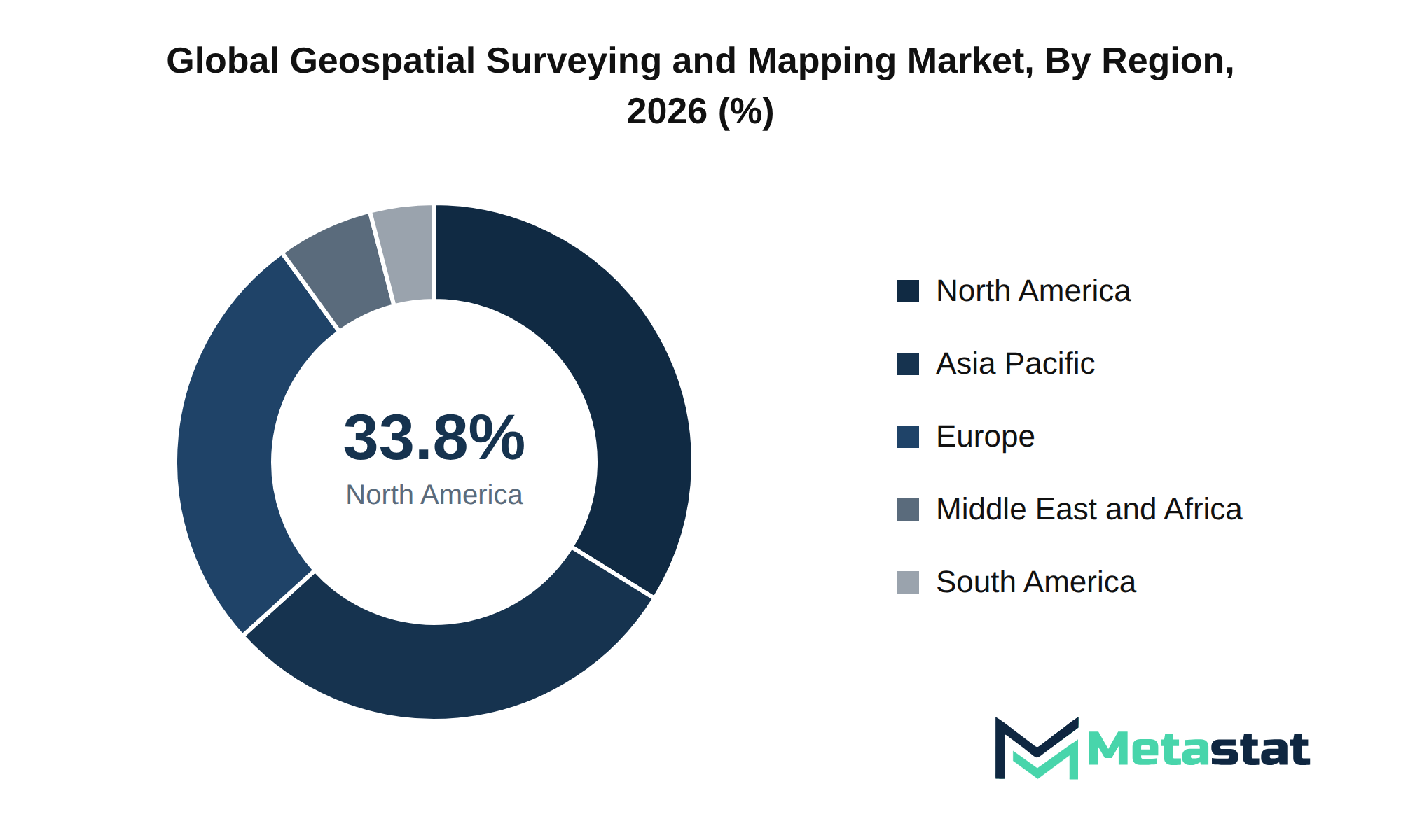
The Geospatial Surveying and Mapping market features a range of companies employing diverse strategies to secure competitive advantage. Key players engage in mergers and acquisitions to enhance their market positions, expand their service offerings, and integrate technological advancements. For instance, companies like Fugro N.V. and AECOM pursue strategic consolidation to streamline operations and optimize resource utilization.
Product differentiation emerges because a crucial strategy, with companies including Esri and Hexagon focusing on proprietary technologies and advanced R&D pipelines. These efforts not only improve the quality of services but create significant barriers to entry for new competitors. Market participants leverage intellectual property portfolios to protect innovative solutions, reinforcing their market positions.
Strategic alliances and joint ventures play a vital role in the market, enabling collaboration across industries to utilize complementary strengths. Partnerships, including those formed by WSP Global Inc. and Digital Globe Inc., facilitate access to new markets and enhance service delivery capabilities. These collaborations enhance customer retention strategies, building brand loyalty and increasing switching costs for clients.
The market anticipates continued growth driven by increasing investment in technological advancements and infrastructure development. Companies will prioritize defensive imperatives, ensuring they remain resilient against startup disruptions and evolving customer demands. The future competitive outlook indicates a dynamic environment where established players adapt to emerging trends while navigating challenges in supply chain dominance and procurement leverage.
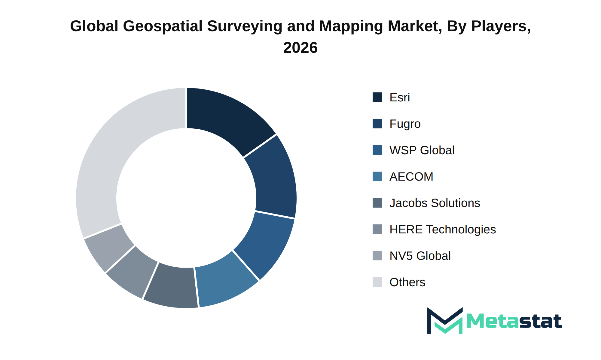
Market size is forecast to rise from USD 23.8 billion in 2025 to over USD 44.8 billion by 2033. The projected growth reflects an 8.2% CAGR, driven by various macroeconomic factors. The primary drivers include advancements in next-generation technology integration, which enhance efficiency and precision in surveying and mapping processes.
The bull case scenario anticipates accelerated adoption rates in emerging sectors, leading to increased investment in infrastructure and technology. In contrast, the bear case scenario concerns potential delays in regulatory compliance and geopolitical tensions that could hinder global supply chain operations. Downstream demand shifts are evident, with core industries evolving and maturing, necessitating a reevaluation of strategic capital allocation across enterprises.
R&D commercialization timelines play a crucial role in shaping the Geospatial Surveying and Mapping market. Timely advancements in product life cycles influence market dynamics, while compliance milestones and regulatory evolution create opportunities for innovative solutions. Emerging white-space opportunities indicate unmet enterprise needs, highlighting high-growth pockets across various sectors.
Investment activities focused on infrastructure commitments and capital expenditure vectors highlight the importance of aligning strategic imperatives with market trends. Evolving trade corridors and geopolitical realignments create a complex environment, impacting market stability and growth trajectory. Executive-level strategic planning will determine the market's adaptability to these changes and shape future growth recommendations.
The report strategically identifies and profiles the key market players and analyses their core competencies in each sub-segment of the Geospatial Surveying and Mapping market.
Report Attributes | Details |
Study Period | 2021-2033 |
Base Year | 2025 |
Estimated Year | 2026 |
Forecast Period | 2026-2033 |
Historical Period | 2021-2025 |
Growth Rate | CAGR 8.2% from 2026 to 2033 |
Revenue Unit | USD billion |
Segmentation | By Service Type, Technology, End-Use Industry, and Region |
By Region | North America (By Service Type, Technology, End-Use Industry, and Country)
|
Europe (By Service Type, Technology, End-Use Industry, and Country)
| |
Asia Pacific (By Service Type, Technology, End-Use Industry, and Country)
| |
South America (By Service Type, Technology, End-Use Industry, and Country)
| |
Middle East and Africa (By Service Type, Technology, End-Use Industry, and Country)
|
Find answers to common questions about this report
The Geospatial Surveying and Mapping market size was valued at USD 23.8 billion in 2025, according to the Metastat Insights study.
The Geospatial Surveying and Mapping market is projected to grow at a CAGR of 8.2% during the forecast period from 2026 to 2033.
The North America Geospatial Surveying and Mapping market size is estimated to reach USD 14.4 billion by 2033.
The segment leading the Geospatial Surveying and Mapping market is Engineering & Topographic Surveying, with a projected value of USD 6.7 billion by 2033. This segment surpasses others in terms of revenue potential within the forecast period.
Key drivers for the Geospatial Surveying and Mapping market include robust capital investment environments, increasing GDP growth, and favorable interest rates, which enhance public and private spending. the push for digital transformation and the need for precise geospatial data due to urbanization and sustainability concerns further fuel market growth.
North America holds the dominant share of the Geospatial Surveying and Mapping market, with a value of USD 14.4 billion projected for 2033, representing 33.8% of the total market.
The Geospatial Surveying and Mapping market faces challenges from regulatory and compliance hurdles, which inhibit market entry and expansion. Stringent regulations related to data accuracy, privacy, and environmental impact necessitate significant investments in compliance processes, affecting profitability and leading to project delays. geopolitical fragmentation and trade barriers complicate international supply chains, increasing costs and straining margins.
Increasing GDP growth and favorable interest rates enhance public and private spending capabilities, facilitating investments in geospatial technologies. the push for digital transformation and automation drives the adoption of advanced surveying techniques, improving data accuracy and reducing project timelines.
The Geospatial Surveying and Mapping market is estimated to reach a valuation of USD 44.8 billion by 2033.
Top players operating in the Geospatial Surveying and Mapping market include Fugro N.V., Jacobs Solutions Inc., NV5 Global, Inc., Woolpert, Inc., WSP Global Inc., Esri, and Hexagon.
The analysts below cover Professional Services research at Metastat Insights.
LEAD ANALYST
Utkarsh Khirodkar is a Lead Market Research Analyst at MetaStat Insight, specializing in market intelligence, technology sector assessments, and competitive strategy.

PRINCIPAL CONSULTANT - ENTERPRISE AI & EMERGING TECHNOLOGIES
Banking & Finance · Electronics and Semiconductor · Energy and Power · Healthcare IT · Information & Technology · Professional Services
Vijay Gunti is a Principal Consultant at MetaStat Insight, bringing over two decades of experience across enterprise digital transformation, technology strategy, and intelligent systems.

PRINCIPAL CONSULTANT - QUALITY SYSTEMS & COMPLIANCE
Electronics and Semiconductor · Machinery & Equipment · Professional Services
Omkar Phadtare is an Industry Consultant at MetaStat Insight, specializing in quality systems, regulatory compliance, and standards benchmarking to drive data-driven market intelligence and strategic industry research.

LEAD CONSULTANT - COMMUNICATION, TELECOM, AND IT
Electronics and Semiconductor · Information & Technology · Machinery & Equipment · Professional Services
Ravindra Sathe Consultants for Communication, Telecom, and IT at MetaStat Insight. He leads the firm's industry research initiatives across telecommunications infrastructure, digital connectivity, enterprise networking, and emerging information technology domains.
When evaluating distributed energy resource management systems, standard research summaries tend to gloss over the operational differences between front-of-the-meter utility deployments and behind-the-meter industrial sites. The MetaStat Insight report addressed those distinctions directly, especially regarding software interoperability standards and grid interconnection backlogs. The five-year market sizing across regional transmission organizations provided actionable context for our grid modernization strategy.
Most industry reports on warehouse automation bundle autonomous mobile robots and fixed conveyor installations into the same top-level numbers, which complicates advisory work. This study split the market cleanly by payload tiers, navigation technology, and fleet management software layers. The regional forecast for Western Europe gave our team defensible adoption benchmarks when evaluating capital allocation for logistics clients, saving us days of secondary data scrubbing.
Standard industry briefs frequently blur the operational distinctions between isobaric pressure exchangers and centrifugal turbines. In this study, MetaStat Insight categorized mega-scale desalination tenders across the GCC and Mediterranean basins by membrane replacement frequencies and salinity tolerances. Their primary research helped us evaluate local content requirements in Saudi Arabia and the UAE without relying on marketing literature. We found the segment-level equipment replacement estimates grounded and well-reasoned throughout.
Explore related market intelligence reports worth reading alongside this one.